Visiting the wild Inishkea Islands in Ireland

Islands with a checkered history

There are two main islands - Inishkea North and Inishkea South. A small third island called Rusheen lies just off the main village on Inishkea South, and several smaller islets trail from its tail. The islands are just off the mainland coast along the Wild Atlantic Way and offer some protection to the Mullet from the power of the wild Atlantic waters. They are now home to a large number of bird species, grey seals, rabbits, many sheep and a few donkeys. It seems that man's removal from the islands has encouraged return of the birds that once numbered so many and were nearly obliterated.


We decided to start with exploring Inishkea north and to venture to Inishkea South in the morning after which we could head back to Clew Bay on the evening tide. It proved to be the perfect plan.
Going ashore
 There is nothing on the Inishkeas aside from history and wildlife. There are no services, no shops, and no bicycle rentals. There is an occasional boat that comes in to bring ornithologists and day trippers. We have heard that one weekend, 18 boats were anchored in the harbour. Today, we were the only ones.
On the North island, a beach provides nice access to the main part of the island where the deserted village leads off into prehistoric and monastic ruins. As the tide was coming in, we did not have to worry about the dinghy drying out. We took enough rode ashore to secure her on the rising tide.
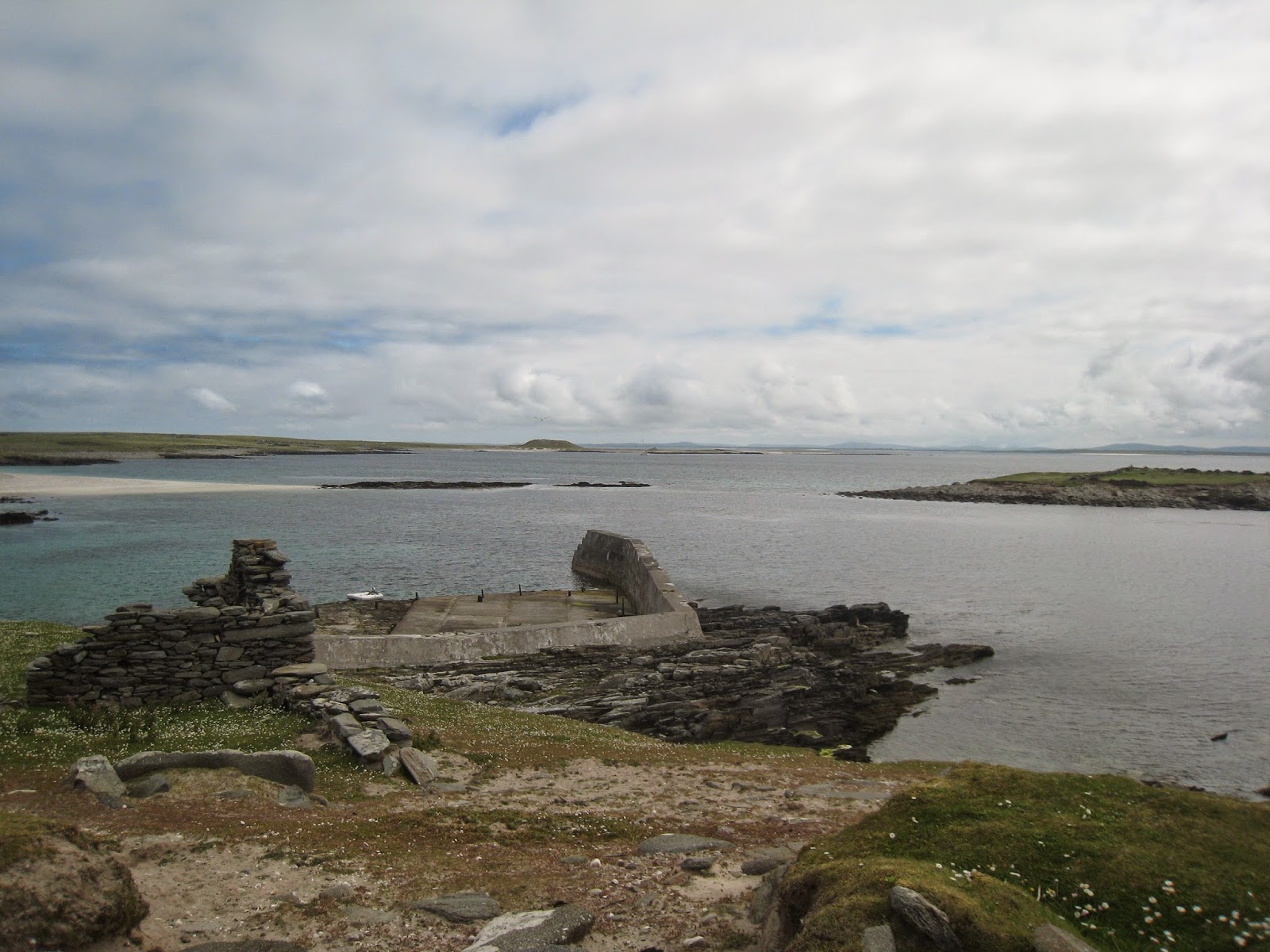
On the South island is a sea wall and a quay alongside which boats can tie up. It is important to protect your dinghy against the surge which can lift it up and bang it against the stone jetty. Alex anchored the dinghy just slightly off the jetty and tied it up to the pier as we embarked on our exploration.
There is nothing on the Inishkeas aside from history and wildlife. There are no services, no shops, and no bicycle rentals. There is an occasional boat that comes in to bring ornithologists and day trippers. We have heard that one weekend, 18 boats were anchored in the harbour. Today, we were the only ones.Navigation
 The Inishkeas are easily accessible from Black Sod where charter boats can be hired. We approached from Clew Bay passing between Clare Island and Achillbeg and past the imposing headlands of Achill Island, Ireland's largest island sporting Europe's tallest cliffs. There is a great contrast here between the sheer rocky cliffs of the mainland and the gentle machair terrain of the Iniskeas and Black Sod Bay. Normally, the seas are confused and boisterous in this area as the waves bounce between Clare and Achill churning up the waters. Today, they were so benign that we finally had a chance to really study the magnificent landscape.
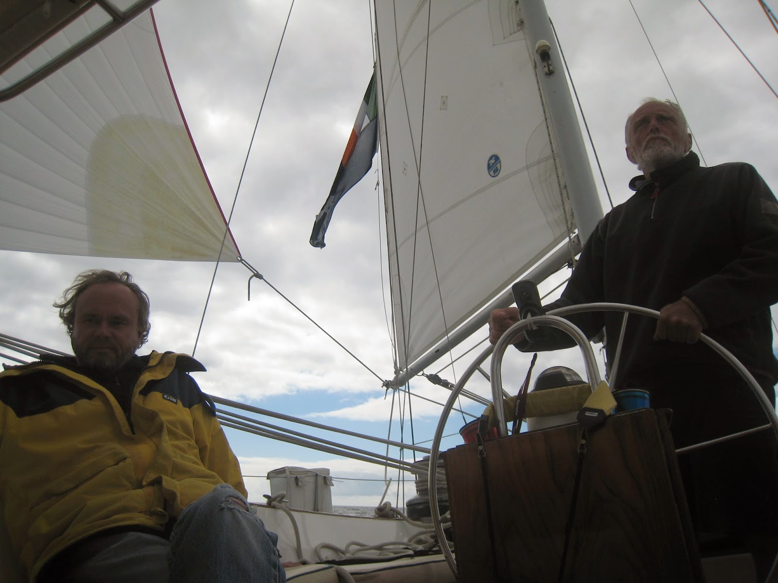
 It is about 40 miles from Clew Bay to the Inishkeas and as luck would have it, the wind was northeasterly allowing us to beat to the northwest, a most direct route. As we basked in sunshine, we watched what looked like a massive fog bank rolling off the tip of Blacksod and reaching up over Inishturk and Caher Islands like the tendrils of a supernatural invader. We each wondered silently to ourselves what we were doing heading out there when it was projected to be the hottest day of the year back home. We knew if we were swallowed up by that fog bank we'd be chilled to the bone instantly. Oh well, at least the breeze was gentle...until we picked up massive gusts coming up and over the cliffs as the land heated up and the sea breezes filled in. And so it went. Breeze kicked up to over 20 knots and back down to less than 10. We were sailing Aleria like a dinghy, following the 40 degree lifts and headers until it breezed up and she did her freight train imitation which she does so very well. Just 7 hours later, we were approaching the anchorage.

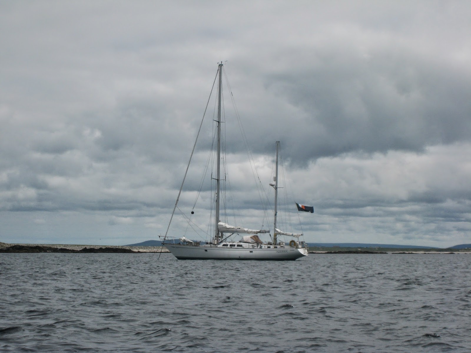
Anchoring in the Inishkeas is like anchoring in an atoll in the middle of the ocean. They give shelter from the sea, but still provide the feeling of being out to sea, not landlocked. The anchorage in the cut between the islands (between the North end of Rusheen and the North end of Inishkea South) provides access to Rusheen and a walled stone jetty where it is possible to land a dinghy, but it is subject to swell through the narrow cut between the north and south islands. The jetty and the cut between Rusheen and Inishkea South do dry out at low tide.
The anchorage off the Baileys (hillocks) on Inishkea North offers good holding in sand and protection from the wind and sea from NE through SW with two reefs extending out from the shore. It is exposed in an easterly and untenable in less than settled conditions. We were fortunate this fine June week as we had several days of settled weather in the forecast. We dropped anchor in 25 feet of crystal clear water and it bit instantly. Time for shore leave.
Topography

The underlying rock of the Inishkea Island is gneiss and schist, the same as that of the Mullet Peninsula. The islands are relatively low lying and are covered in machair. Machair is a Gaelic word meaning "fertile plain", but the word is now used in scientific literature to describe the dune grasslands unique to western Scotland and northwest Ireland. Fine sand everywhere creates lovely stretches of white sand beaches which hold back crystal clear blue-green waters. It is often blown into drifts by the strong winds especially along the beach beside the harbour where it fills the houses of the abandoned village on the south island. The storms of the winter of 2013-2014 exacted their toll here, and much of the waterfront grassland was washed away bringing the sea perilously close to the doorsteps of the ghost town.

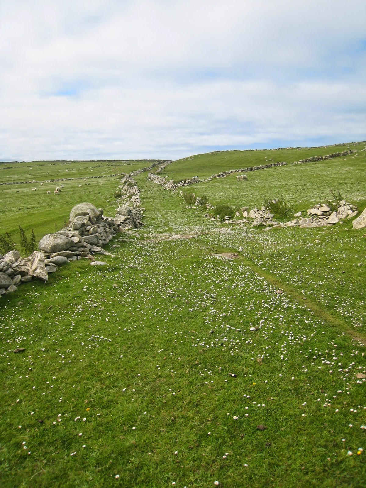
Topographically, these islands resemble the Outer Hebrides in Scotland more closely than most of the surrounding Irish coastal areas which are typically fringed in high cliffs that tumble straight down to the sea and rocky promontories that lead into hilly bays along the west coast. From the tops of the hills, one gazes over small fertile plains, most likely created over centuries of seaweed and sand being mixed into the mounds we know as lazybeds where potatoes were grown for sustenance. The lazybeds stretch for miles; during the famine, these islands were reputedly not affected because the blight did not make it out this far offshore.
Natural and Human History


On the south island is a tall cross-inscribed slab and the ruins of a small church with a large uncarved slab in its doorway, an alter stone, and a hollowed out prayer stone. Inishkea must have been an important centre for stone carving in the early Christian period.
In more modern history, the Inishkeas were inhabited from the late 1700s until the 1930s, leaving a gap of hundreds of years between the times when monks ground up whelks to produce the immensely valuable purple dye used to illuminate manuscripts in St. Columba's scriptoriums to when fishermen reputedly made poitin and lured passing ships to wreck on its shores for salvage. In their heyday, the islands had some 60 houses and 300 people living self-sufficiently. In 1908, a group of Norwegians driven out of their native land by stricter laws regarding whaling set up a whaling station in Rusheen employing many from the south island and drinking poitin in their pubs, thereby contributing significantly to the economy. It only lasted 10 years and now there is only rusty evidence of its existence, bar the fascinating movie of whaling created by an early pioneer of moving pictures. https://www.youtube.com/watch?v=huabPmS9mmM

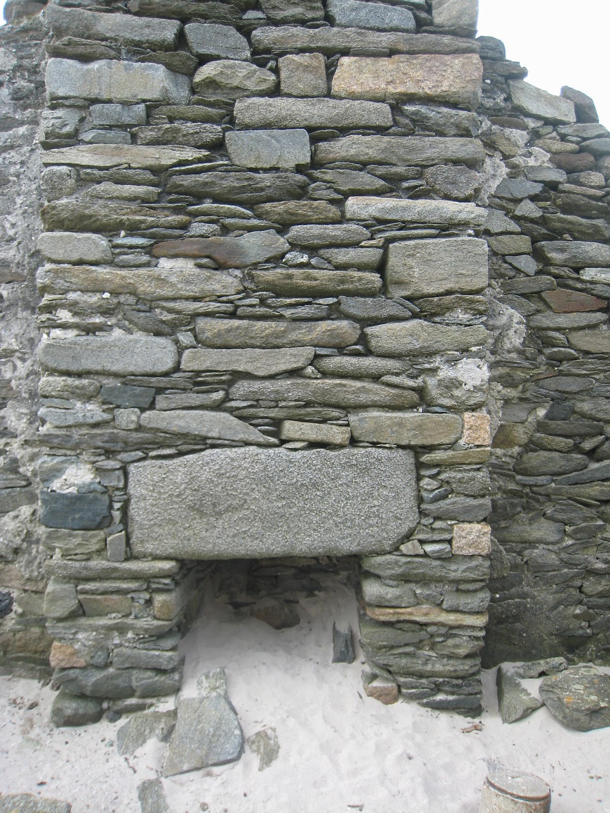
The inhabitants of both Inishkeas, North and South, left the islands in the 1930s after many of their young men died in a violent storm that caught them unaware in 1927 while they were fishing at sea . The last known survivor of the resident population of the Inishkeas Pat "Rua" Reilly passed away at age 101 in 2008. He was interviewed by Turtle Bunbury for the Vanishing Ireland series. It was eerie walking through the deserted villages and imagining life on the islands, both glorious and treacherous. One abandoned home still had its beds and shelves intact and in place, with several ancient shoes left behind to remind us of those who toiled there.
The islands are also home to several protected species of plants and birds, including barnacle geese. Dr. David Cabot has been surveying the population of overwintering barnacle geese for decades. The geese visiting the Inishkeas number more than 2500 on average, an internationally significant population.
We had a fascinating glimpse at the wonder of these islands and feel blessed that they have as yet been undisturbed from their recent rest period. As we were getting ready to leave, a fisherman named Michael came by to pick up an ornithologist from the island and shared a couple of pollacks and some stories with us. It was a pleasant ending to an inspiring two-day visit. We hope to return soon to continue our journey into the past, and hopefully spend a bit more time basking in the spirituality of the place.
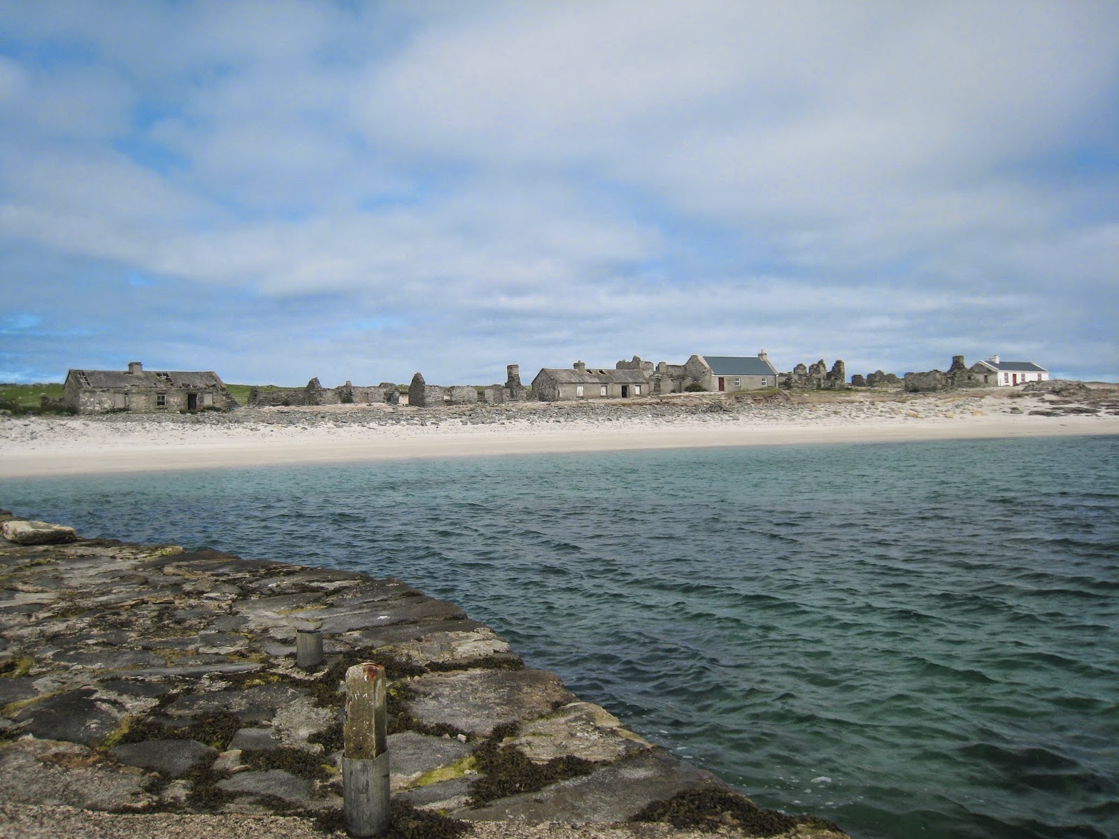


Comments
Post a Comment